Best hiking in Seoul — a local's guide by difficulty level
🏔️ Table of contents
- Intro — Seoul is a surprisingly great city for hiking
- Achasan — easy, rewarding, 15 minutes to the view (★☆☆)
- Cheonggye Mountain — best access from Gangnam (★★☆)
- Bukhansan — Seoul's most celebrated mountain (★★★)
- Gwanaksan — the mountain I grew up with (★★★)
- Practical hiking tips for Seoul
- Final thoughts — Seoul has more mountain than most cities deserve
Intro — Seoul is a surprisingly great city for hiking
One of the things that consistently surprises first-time visitors to Seoul is the mountains. You step out of a subway station in what feels like the middle of a dense urban city, look up, and there's a mountain ridge right there. Thirty minutes by public transit from central Seoul, you can be on a proper hiking trail in a national park. Seoul is genuinely one of the best major cities in the world for accessible hiking, and locals take full advantage of it — on any clear weekend morning, you'll see streams of people heading toward the trailheads in hiking gear, regardless of the season.
I grew up near Gwanaksan in the Nakseongdae area, and that mountain is woven through my childhood memories in a way that's hard to separate from the place itself. Family weekend walks along the valley stream, school events that somehow always ended up on the mountain trails, splashing in the creek with friends. I've been hiking Seoul's mountains most of my life, and I know them at different levels of effort and in different seasons. This guide covers four of the best options — organized by difficulty — so you can choose the right one for your time and energy.
Achasan — easy, rewarding, 15 minutes to the view (★☆☆)
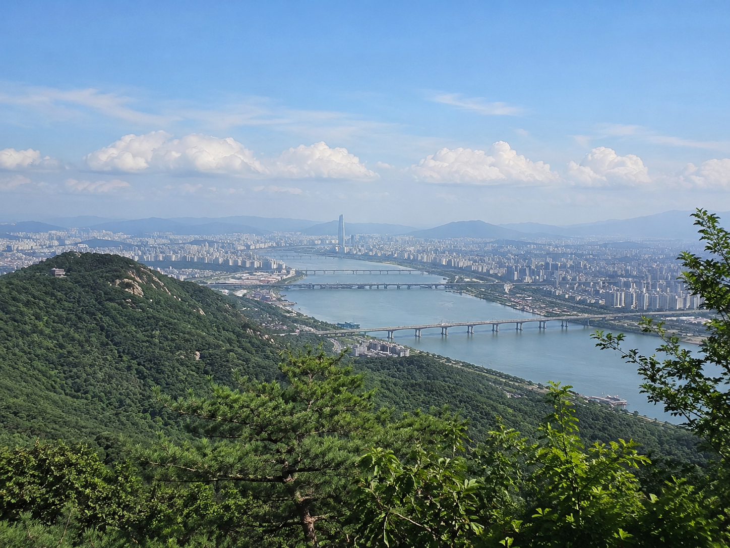
For anyone who wants a meaningful Seoul viewpoint without committing to a proper hike, Achasan is the answer. Using the right shortcut trail, you can reach the Haemaji Park observation deck in around 15 minutes — making it genuinely accessible for children, hiking beginners, and visitors who want a panoramic view of the Han River and the Seoul skyline without significant physical effort. I've been here with my child and it was the right call — short enough not to exhaust small legs, rewarding enough that everyone at the top understood why we came.
The key is using the right entrance. The fastest shortcut runs alongside the Younghwa Film Center and Younghwa Kindergarten in Guui-dong — this is the local's route that makes the 15-minute summit possible. For Naver Map navigation, search the address Guui-dong 3-16 (구의동 3-16) — this gets you directly to the correct trailhead. The observation deck at the top delivers a view that feels disproportionate to the effort: the Han River, the bridges, and the Seoul skyline spread out in a full panorama that surprises people every time.
The mountain is also accessible from Gwangnaru Station or Achasan Station on Line 5. A natural extension after descending is to walk down to the Han River for a picnic — the park is right there, and the combination of a short hike and a riverside afternoon makes for one of the better low-effort Seoul days.
Achasan essentials: Difficulty: easy. Shortcut via Guui-dong 3-16 → Haemaji Park deck in 15 min. Han River panorama. Best for children, beginners, and anyone short on time. Line 5 Gwangnaru or Achasan Station.

Cheonggye Mountain — best access from Gangnam (★★☆)
For visitors staying in Gangnam, Cheonggye Mountain is the closest proper hiking destination. Sinbundang Line Cheonggyesan-ipgu Station connects directly to the trailhead — this is the mountain that Gangnam and Pangyo office workers visit on evenings and weekends, which tells you something about how accessible it is. The mountain straddles Seoul, Seongnam, and Gwacheon, offering multiple route options depending on which side you approach from.
The most recommended route for visitors is the Wonteogol entrance to Maebong Peak — 2.8km one way, about 1 hour 30 minutes. The path is mostly staircase, which makes navigation straightforward and reduces the chance of getting lost. At the top, the view opens over the southern Seoul area in a way that's genuinely satisfying after the climb. The mountain's name means "clear stream mountain" — the streams running through the valley trails live up to it. The Gwacheon approach is a gentler alternative at 3.7km and around 1 hour 50 minutes, with a lower elevation gain and more rest points along the way — good for those who want the experience without the steepness.
Cheonggye Mountain essentials: Difficulty: moderate. Sinbundang Line Cheonggyesan-ipgu Station direct access. Wonteogol to Maebong: 2.8km, ~1.5 hours. Top choice for Gangnam-area visitors.
Bukhansan — Seoul's most celebrated mountain (★★★)
If you ask any Seoulite which mountain best represents the city, most will say Bukhansan. Designated as a national park and covering a significant area of northern Seoul, it's the most complete hiking destination in the capital — granite peaks, forested valleys, Buddhist temples, historic fortress walls, and views that extend across the entire metropolitan area. For international visitors who want to say they properly hiked a Seoul mountain, this is the one.
Moderate route — Daenammun Course
Starting from Gugidong탐방 Support Center and ascending to Daenammun Gate: 2.4km one way, about 1 hour 20 minutes. The trail follows a valley stream with nine named bridges, walking through a forested path that's beautiful in every season. The historic Munsu Temple — founded in the Goryeo period — sits along the route. This is the course I'd recommend for visitors doing Bukhansan for the first time: accessible, scenic, and genuinely satisfying without requiring elite fitness.
Advanced route — Baegundae Summit
Bukhansan's highest peak at 836 meters. The summit approach involves exposed rock sections that require care — not recommended for complete beginners or anyone without appropriate footwear. But the view from the top — Seoul spread out in every direction, a Korean flag flying at the summit — is one of the most dramatic city panoramas you'll find anywhere in Asia. The Hidden Wall (Sumeunbyeok) course is even more demanding but rewards with scenery that most visitors never reach.
Access from Line 3 Gupabal Station, Line 4 Suyu Station, or Ui-Sinseol Line Bukhansan Ui Station depending on which trailhead you're using.
Bukhansan essentials: Difficulty: moderate to hard. No entrance fee (national park). Beginners: Daenammun Course (2.4km, ~1.5 hrs). Summit seekers: Baegundae (proper hiking experience needed). Multiple subway access points.
Gwanaksan — the mountain I grew up with (★★★)
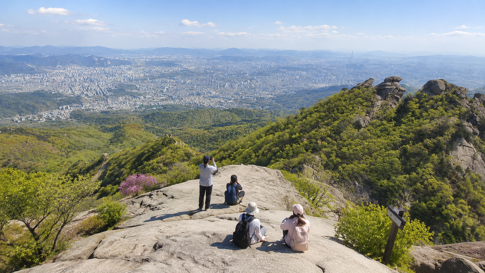
This one is personal. I grew up in the Nakseongdae area — right at the base of Gwanaksan — and this mountain is part of my earliest memories in a way that none of the others are. Weekend family walks up the valley where the stream runs cold even in summer. School events where somehow the outdoor activities always ended up on Gwanaksan's trails. Sitting in the creek with friends after the climb, feet in the water, completely content. That mountain shaped my sense of what a city mountain could be.
Gwanaksan stands at 632 meters and encompasses Seoul National University's campus within its footprint. The summit — Yeonjudae — offers views that extend from Seoul all the way to Incheon on clear days. I climbed to Yeonjuam Temple once as a child with my family, and I was completely destroyed the next day — every muscle complaining about the decision. That tells you what kind of climb it is. It's genuinely demanding, and it earns the view.
What I find remarkable now is how many young Koreans are climbing Gwanaksan — the mountain that felt like a serious physical challenge to me as a child is now packed with hikers in their 20s treating it as a casual weekend outing. That's impressive. Multiple trailheads are available from different sides: the Gwacheon Temple route from Gwacheon Station on Line 4, routes from Nakseongdae Station or Seoul National University Station on Line 2. The valley streams make it particularly popular in summer.
Gwanaksan essentials: Difficulty: hard. 632m. Summit views reach to Incheon. Beautiful valley streams, popular in summer. Line 2 Nakseongdae Station / Seoul Nat'l University Station or Line 4 Gwacheon Station.

What to wear and bring
Proper hiking shoes or at minimum sturdy sports shoes are essential. Seoul's mountains have significant rock sections where sandals or flat shoes become genuinely dangerous. Bring more water than you think you need — particularly in summer when the heat on exposed sections is significant. Sunscreen and a hat matter from May onward. In winter, hiking gloves and crampons (아이젠, ice grips) are necessary for icy trails.
Navigation apps
Korean hiking apps Tranggle (트랭글) or Sansam (산길샘) provide GPS trail maps that work offline — extremely useful for international visitors who may not read Korean trail signs. Download the relevant map before you leave for the mountain. Naver Map also covers most trailheads accurately.
Timing
Start early — especially for Bukhansan and Gwanaksan. An early morning departure means cooler temperatures on the ascent, fewer crowds at the popular viewpoints, and enough daylight buffer for the descent. Arriving at a trailhead after 1pm for a full-day mountain is cutting it close.
After the hike — makgeolli and pajeon
Around the base of most Seoul hiking areas, especially near Bukhansan and Gwanaksan, there are restaurants specializing in makgeolli (막걸리, Korean rice wine) and pajeon (파전, savory green onion pancakes). Post-hike makgeolli is a genuine Seoul hiking tradition — the combination of physical exhaustion, cold rice wine, and hot pancake in a mountain-adjacent restaurant is one of those experiences that's difficult to explain and very easy to love. Don't skip it.
Final thoughts — Seoul has more mountain than most cities deserve
A city with mountains this accessible and this beautiful sitting within its own boundaries is unusual. Most global cities of Seoul's density and scale don't have anything like it. The fact that you can take a subway from the center of one of Asia's largest cities and be on a national park hiking trail in under an hour is something that deserves more attention than it gets.
Choose your difficulty honestly. Achasan if you want a view without the commitment. Cheonggye Mountain if Gangnam is your base. Bukhansan if you want the full Seoul mountain experience. Gwanaksan if you want the challenge and the history that comes with the oldest mountain on this list. And whatever you climb — stop for makgeolli on the way down. That part is non-negotiable. Have a great hike! 🏔️
'Korea Travel Tips' 카테고리의 다른 글
| What not to do in Korea — a local's honest guide to Korean etiquette (1) | 2026.05.28 |
|---|---|
| Wolmido Incheon — Is It Worth a Day Trip from Seoul? (0) | 2026.05.24 |
| Peak Seasons to Reconsider: Avoiding the Crowds in Korea (0) | 2026.05.22 |
| Where to Eat Bingsu in Seoul — Mango, Sulbing & Local Picks (0) | 2026.05.20 |
| When Is the Best Time to Visit Korea? — A Local's Honest Month-by-Month Guide (0) | 2026.05.18 |


